Sugarloaf Mountain Resort, Carrabassett Valley, ME
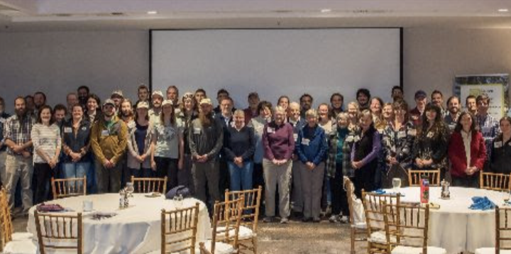
The Maine Appalachian Trail Club and the Waterman Fund will co-host the Northeastern Alpine Stewardship Gathering at Sugarloaf Mountain Resort, highlighting the alpine areas throughout the Northeast. This meeting is designed for alpine researchers, land managers, stewards, and interested parties to share information and improve the understanding and stewardship of the alpine areas of Northeastern North America.
Please Support the Northeastern Alpine Stewardship Gathering
The Maine Appalachian Trail Club and the Waterman Fund are co-hosting the Gathering, bringing together practitioners, researchers, stewards, land managers, activists, artists, and writers to share knowledge, inspire new ideas, and strengthen collaboration in support of the Northeast’s alpine environments. Learn more at: https://www.watermanfund.org/northeastern-alpine-stewardship-gathering/
Your generous support will help shine a light on the unique alpine landscapes of the Northeast and the people dedicated to protecting them.
Click the link make a donation and/or sponsor the Gathering:Donation Form
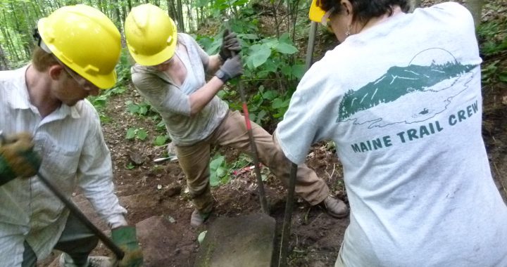
The Maine Trail Crew repairs steep, rugged, and degraded sections of the Appalachian Trail, helping to protect and preserve this treasured resource for future generations.
Volunteers (age 18+) are invited to apply to join our paid crew for one or more of the following sessions: June 29 – July 3; July 6-10; July 13-17; July 20 – July 24; August 3-7; August 10-14; August 17-21; August 24-28
Projects run Monday morning through Thursday or Friday afternoon. Crew members must arrive by 4:00 PM on Sunday before their session begins. An enthusiastic and experienced staff looks forward to welcoming you and building trails together
Contact MATC Club Coordinator, Holly Sheehan (coordinator@matc.org) if you are interested in volunteering your time with the Trail Crew.
COME WORK WITH US! MAINE TRAIL CREW
VOLUNTEER INFORMATION
What You’ll Do:
Projects focus on rebuilding and restoring heavily impacted trail sections. Crews use rigging equipment and hand tools to construct stone steps, install waterbars, improve drainage, and stabilize steep terrain.
Who Should Apply?
We welcome individuals 18 years or older from all backgrounds. Ideal crew members bring enthusiasm and positive energy, good physical health, adaptability and teamwork, willingness to follow instructions and safety guidelines, readiness to share camp chores.
Trail experience is helpful, but not necessary — we’ll teach you the skills you need.
Benefits:
Transportation to and from Maine air, train, and bus terminals
Tents and backpacks provided if needed
Housing, meals, and transportation to project sites
Days off at the Maine Trail Center in Skowhegan, Maine
Section 27. Little Wilson Falls to Leeman Brook Lean-to. This is a long (6.92 miles) section that does not involve significant climbing but includes some rough terrain.
Section 34. Horseshoe Canyon Lean-to to Marble Brook. This 5.03-mile section lies on both sides of the West Branch of the Piscataquis River, so monitoring requires crossing the river. All of the section lies in the valley cut by the West Branch so there is some side-hill walking.
Section 35. Marble Brook to the Outlet of Bald Mountain Pond. This section is easily accessible from the Breakneck Ridge Road in Blanchard (may need permission to pass through gate) and covers 5.29 miles of boundary line over nearly flat terrain.
Section 36c. West of Bypass Trail to Moxie Pond at Joe’s Hole. This assignment includes 5.5 miles of boundary line over the west side of Moxie Bald Mountain. Good access via gravel roads.
Section 38. Middle Mountain (of Pleasant Pond Mtn.) to Boise Road. This very scenic assignment includes 3.95 miles of boundary line over the northerly portion of the Pleasant Pond Mtn. ridge. Excellent access from the logging road near Pleasant Pond.
Section 43. North Branch Carrying Place Stream to Sandy Stream. This assignment includes 6.85 miles of boundary line over very gentle but somewhat wet terrain. It is accessible over the A.T. from the gravel Carrying Place Road.
Section 44. Sandy Stream to the SW inlet of West Carry Pond. This assignment includes 4.8 miles of boundary line over flat but sometimes swampy terrain. It is accessible over the A.T. from the Long Falls Dam Road or from the gravel Carrying Place Road. The section was carefully monitored and maintained for many years by Bill Geller and the boundary lines were renewed by A.T.C. Boundary Technicians in 2020 and 2021.
Section 50/51. West Peak of Bigelow to Bigelow Range Trail. All of this section is on State of Maine land so there are no boundary lines to walk. Just walk the A.T. and observe conditions along the way.
Section 54. North Crocker to Caribou Valley Road. This assignment includes 5.3 miles of boundary line that is easy to access but requires considerable climbing. Great views!
Section 57a. Mt. Abraham Side Trail to Barnjum Road. This section includes 3.6 miles of corridor boundary lines. Good access so long as Barnjum Road is passable and relatively gentle terrain.
Section 63b. Middle of Bemis Ridge to Bemis Stream Side Trail. This section includes 5.37 miles of corridor boundary lines over sometimes rough sidehill terrain. Access requires hiking in over the A.T. or over the gravel Bemis Stream Road, which begins at the gravel road between Mooselookmeguntic Lake and Houghton on Route 17. The Bemis Stream Road is gated but may be made available, although it is suited only for 4-wheel drive at best.
Section 67. Hall Mtn. Lean-to to Wyman Mtn. This section includes 4.2 miles of corridor boundary lines along gentle terrain, but requires a hike and a climb to reach either end.
We’re looking for a person or two to coordinate campsite maintainers. This role involves duties in the field as well as administrative work (email etc.). Here are the job duties:
Recruit, interview, and select maintainers for campsite vacancies (MAINEtainer, website, etc.)
Perform new maintainer orientation and education Aid, train, and communicate with new and existing campsite maintainers in the performance of their duties
Ensure maintainers are current members of the Club and have signed the Volunteer Service Agreement (VSA)
Review incoming work trip reports and monitor activities (and inactivity) of campsite maintainers
Recommend replacement of campsite maintainers when circumstances warrant
Communicate and coordinate work needs beyond the capability of the maintainer to the Campsite Manager, and District Manger as appropriate
Work with the Campsite Manager to provide written annual summaries of work performed by maintainers and issues encountered
Thank you for your interest in updating your contact information!
Please fill out the form below to ensure we have the most accurate details on file. Your information is important to us, as it allows you to stay informed about Club news and events that matter to you. Or click this link if you have trouble viewing the form.
We want to assure you that the MATC will never share your information with any other organizations without your explicit permission. Your privacy is our priority.
One day during August 8-11, the Maine Appalachian Trail Club (MATC) will be working with a helicopter contractor to airlift 12,000 pounds of lumber and tools to the Cloud Pond Campsite, Chairback Gap Campsite, and Fourth Mountain bog. Materials will be used to build new privies at the campsite, and install new bog bridging through the bog.
The date will be the first good weather day during the period August 8-11. The activity will last about 1-2 hours at each location.
Several volunteers will be at the campsites and bog assisting with the effort. Please heed any instructions by volunteers to keep their activities running smoothly and everyone, including you, safe.
Sample three different sections of the famed Appalachian Trail as it winds through the Maine wilderness, with a look at some other fun activities to pursue along the way. This special episode stops in Carrabassett Valley for an overnight stay at the Horns Pond shelter in the Bigelow Range, followed by some mountain biking at Sugarloaf Mountain and kayaking on Flagstaff Lake. Next is a day hike to Pierce Pond in the Kennebec Valley Region, along with a whitewater rafting trip on the Kennebec River and an ATV ride at Northern Outdoors Lodge in The Forks. Wrapping things up is a hike up Barren Mountain in the 100-Mile Wilderness and a visit to the towns of Abbot and Monson, home to beautiful Lake Hebron.
MATC President Tom Gorrill is interviewed in Episode 2 of Borealis! You can watch it on Maine Public’s YouTube channel. Borealis is a new multi-media outdoors series hosted by Aislinn Sarnacki and produced by Maine Public highlighting. This episode also features Native Nyle “River” Sockbeson who thru hiked the AT this summer to inspire Wabanaki youth and raise awareness to indigenous lands and cultures along the Trail.
9/14/23 Update: The National Hurricane Center is predicting winds and rain from Hurricane Lee will impact Maine Friday evening (9/15) through Saturday night. The predicted track could change, so hikers should continue to monitor the forecast.
Stream flows are already challenging due to significant rain on Tuesday and Wednesday. As of 11:30 AM on 9/14, the USGS gage on the Piscataquis River in Blanchard was at 644 cfs, more than three times the flow at which we expect stream crossings to become challenging. The National Weather Service is predicting significant additional rain on Saturday. The rain will fall on saturated ground into already swollen streams increasing stream flows even further. The Appalachian Trail Conservancy Monson Visitor Center also has information. For more information about Hurricane Lee, visit the National Hurricane Center’s website.