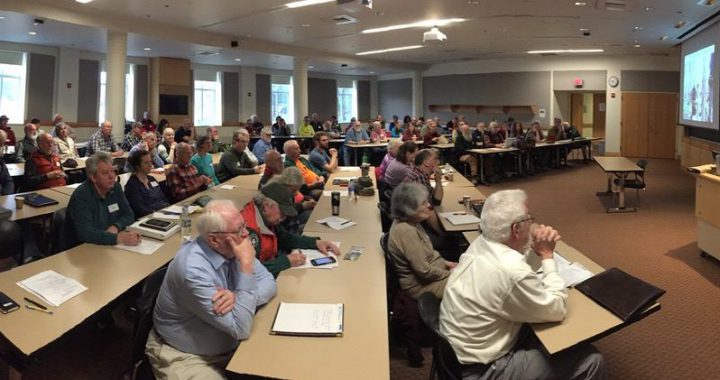
Read the latest MAINEtainer Newsletter

Read the latest issue of the MAINEtainer, MATC’s quarterly newsletter.

FALL 2020 EDITION

  • NE Regional Partnership Committee holds virtual meeting ZOOMING NERPC
  • MATC Maintainer’s Meeting Survey
  • Power Hedgers for Clearing/Brushing/Trimming  – My New Favorite Trail Tool
  • End of the Trail – Carrington Rhodes
  • Maintainer Openings – White Cap District
  • Remembering Dick Innes

You can view the current year’s issues as well as look into the MAINEtainer archives.

White Brook Trail

One of the most remote areas of the A.T. in Maine – now newly accessible via the White Brook Trail.

“The highest mountain in the Hundred Mile Wilderness is easier to access thanks to recent improvements and trail relocations.”

Maine Appalachian Trail Land Trust
November 20, 2020

White Cap Mountain was protected by the Gulf Hagas Whitecap project in 2017, which was completed by the Forest Society of Maine, the Maine Bureau of Parks and Lands and the Maine Appalachian Trail Land Trust.White Cap is the highest mountain in the fabled Hundred Mile Wilderness and the trail this organization maintains – the White Brook Trail – is more accessible than ever.

Take a tour of the project and learn about the ecology, history, recreation and volunteerism at White Cap Mountain.

ArcGIS StoryMaps combine photos, video, maps and text to create an innovative format for telling the story of Maine’s Appalachian Trail and some of it’s most amazing locations.  

Click above for an immersive journey to White Cap Mountain from your computer or mobile device.

Your support is critical for the stewardship of incredible landscapes like White Cap Mountain. Please consider donating today to help us preserve this treasured resource.

P.O. Box 761, Portland ME 04104

Our Volunteers Rock!

Rocks aren’t placed by magic; it takes lots of hands and strong backs to make rock steps.

Volunteers build stone steps at Gulf Hagas using pry bars, shovels, grip hoist and pick axes.

MATC Affiliate Store

Get MATC Gear!

Show your support for MATC by proudly wearing and displaying official clothing and accessories emblazoned with the MATC logo. Check out the variety of MATC branded items at our “Trading Post” – on-line store.

MATC has partnered with Spreadshirt to provide MATC branded clothing and accessories to members and supporters of the Maine Appalachian Trail Club. Items are available in a variety of styles and colors.

MATC is a non-profit, 501c3 charitable organization and does not make any profit on these items. Spreadshirt is a third-party, affiliated vendor who handles all sales and questions regarding their products.

MATC Store

Saddleback Mountain

MATC’s Position on Saddleback Ski Area Solar Project

Regarding the Saddleback Ski Area Solar Project

We encourage the owners of the Saddleback Ski Area (Arctaris Impact Fund) to move the location of its proposed grid-scale solar power generating facility to a location that would not impact the views from the Appalachian Trail (A.T.) on Saddleback Mountain.  At just over three miles away, the proposed 35-acre solar array would become the dominant feature on the landscape view looking north from the A.T.

Other than Katahdin, Saddleback offers the longest open ridge walk along the A.T. in Maine and about 1.5 miles of this section would have frequent views of the solar development.  Given the facility’s high contrast and reflective panels tilted towards the mountain, the array would draw visitors eyes towards them and create a negative impact on what is now a natural view of lakes, forests and mountains. 

Saddleback Ski’s stated objectives to move off fossil fuel and source with 100% solar electricity are admirable.  We believe Saddleback Ski can reduce its carbon footprint and lower its electricity costs through a less impactful alternative:

The Maine Appalachian Trail Club (MATC) and the Appalachian Trail Conservancy (ATC) hold the position that development must be balanced against the recreational, scenic, natural and cultural resources of the Appalachian Trail (A.T.).  As stewards of the A.T. in Maine, part of MATC’s mission is to preserve the scenic integrity and minimize development impacts adjacent to the A.T.

Both the ATC and MATC support Saddleback Ski moving to 100% solar-sourced electricity and encourage them to seek alternatives that would have less impact on the views for the visitors to the Appalachian Trail and Saddleback Mountain.

View from Saddleback
The solar farm is proposed to the right of Saddleback Lake seen in the middle ground, to the right of the hiker.

Leaves and Drainages: A Muddy Mix

It’s fall. That time of year with crisp air, shorter daylight hours, crunchy apples… and what else? Falling leaves! This vibrant foliage settles in voluminous quantities onto the ground in our yards. And the A.T. isn’t immune to this annual jettison of foliage either. But on the A.T. it can create problems with water drainages if not addressed. When it rains the leaves wash into these drainages where they often accumulate in the narrow or flatter locales, essentially damming the flow of water. Where’s the water to go now? In the trail! Water is ruthless and will find its way around and over obstacles if its designed flow path is interrupted, and either erode the trail, create a mud hole, or perhaps ruin the drainage structure itself. What’s a trail maintainer to do? Grab your favorite hoe and go for a nice walk on your trail section, combing the drainages and their outflows of leaves. Don’t think you are out of the woods if your trail section is mostly non-deciduous trees. Needles shed from softwood trees can cause the same issues! It’s a great time of year to be in the woods, so please consider purging your drainages of leaves, and needles, to keep water off the trail!

Trail before drainage cleaned- muddy…
Drainage full of needles and leaves
Drainage after it was raked out.
Trail after drainage cleaned- no more pooled water!

Illegal Fire Ring

Illegal Fire Rings Concerning on AT

ILLEGAL FIRE RINGS: In Maine, campfires in the woods require a fire permit or a permitted campsite to be legal.  WIth the dry conditions this Fall, non-permitted campfires along the A.T. are especially concerning.  A frequent task for maintainers is to dismantle and disperse fire rings which not only encourage more camp fires in inappropriate locations but also encourage trash accumulation.  This particular fire ring just north of Orbeton Stream has been dismantled four times this season.

Photo by @Tony Barrett

4x6 Corridor

4-ft X 6-ft

4-ft X 6-ft: Trail maintainers are tasked with keeping a 4 X 8 foot corridor along the tread way for clear hiker passage. “One should be able to carry a 4X8’ sheet of plywood upright through the woods”.  That standard is a high bar to meet in some places.

Photo by Tony Barrett

An Ideal Time for Corridor Monitoring

THE FALL IS AN IDEAL TIME FOR CORRIDOR MONITORING: Simon Rucker, Mike Mahony, Mary Eagan and Kayla Gagner are happy to find a boundary marker without any digging. This section of A.T. corridor is just south of Long Falls Dam road.

Photo by Tony Barrett

Bog Bridging White Cap

Kudos to Maintainers

We received a nice note from a happy hiker….

I hiked from Gorham, NH to Caratunk, ME two weeks mid-Sept. and was very impressed at how well the trails were maintained. I was also impressed at how much planking there was along marshy areas, showing your respect of the underlying ecosystem. Please share my thanks to all the Trail Maintainers along these sections.

– LightWalker
MATC volunteer Brad testing the new bridging-near East Branch