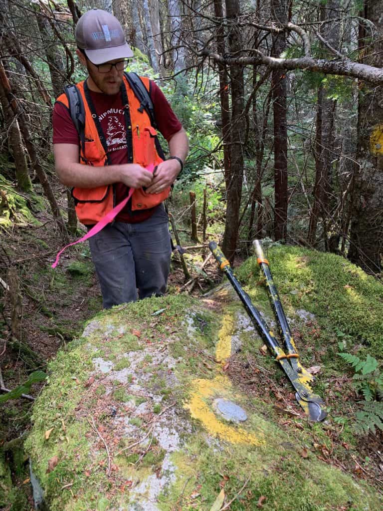
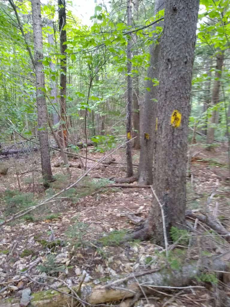
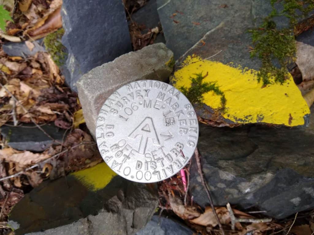
THE FALL IS AN IDEAL TIME FOR CORRIDOR MONITORING: Simon Rucker, Mike Mahony, Mary Eagan and Kayla Gagner are happy to find a boundary marker without any digging. This section of A.T. corridor is just south of Long Falls Dam road.
I hiked from Gorham, NH to Caratunk, ME two weeks mid-Sept. and was very impressed at how well the trails were maintained. I was also impressed at how much planking there was along marshy areas, showing your respect of the underlying ecosystem. Please share my thanks to all the Trail Maintainers along these sections.
– LightWalker
MATC volunteer Brad testing the new bridging-near East Branch
Volunteers Improve the White Brook Trail on the AT in Maine – 9-19-2020
The current White Brook trail is an official Appalachian Trail side-trail. It goes up the south side of White Cap Mountain. The trail itself is a remnant of the original AT when it went up the White Brook from the KI road. There is a steep, badly eroded section that is 3 feet deep in places. A relocation of this section has been approved for a couple of years. It will do a 900′ foot bypass to the West of the current section.
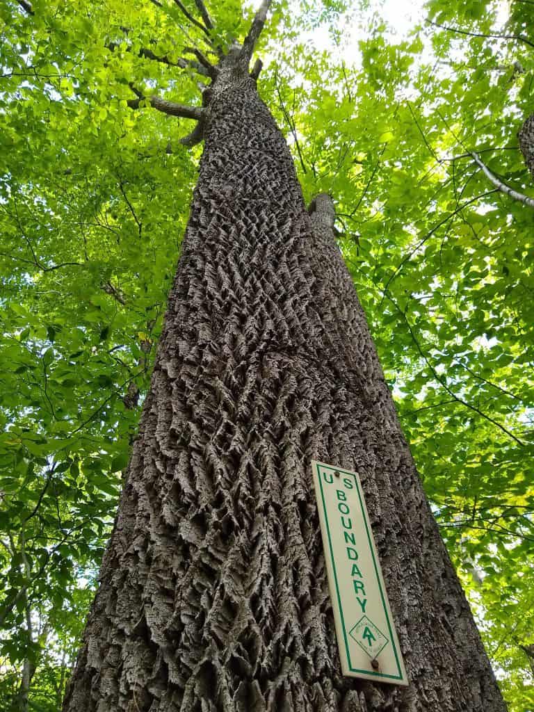
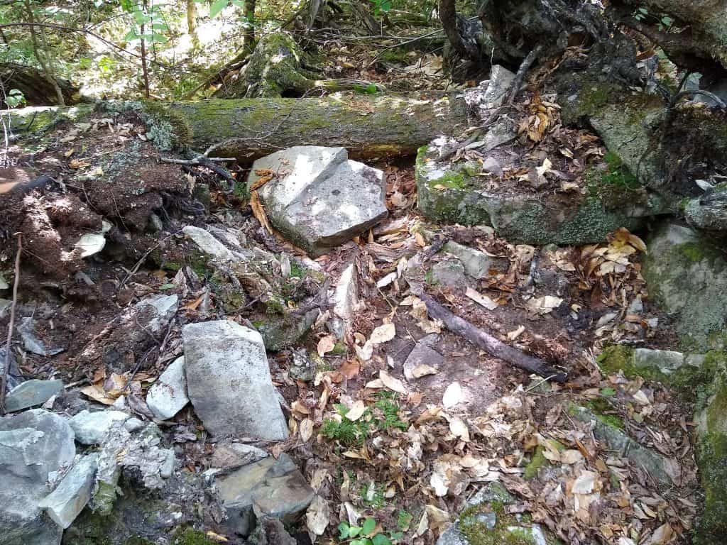
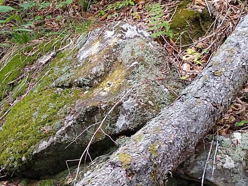
Corridor monitoring…What is that you ask…I call it a walk on the wild side. It means following the property boundaries of a property. In our case, the Appalachian Trail in Maine. We are responsible for a section from Big Wilson Stream to Long Pond Stream in the 100 Mile Wilderness. Sometimes you get great views and sometimes you just enjoy the little things nature has to share with you. It’s like going on a geocaching hunt except you are looking to follow the survey line and find monuments marking the line or corners. Some are well hidden, some you easily seen. If you enjoy a wild walk, this may be just the thing for you to join in on. Great isolation. If not on the AT, maybe with your local land trust. It’s a great way to give back to those trails you love. Click here for more info on MATC’s work in Maine.
We have some BIG news to share. One of the Appalachian Trail’s most iconic stretches is now permanently protected.
Cold, clear Bald Mountain Pond in Northern Maine welcomes paddlers and anglers from across the country. Hikers on the Appalachian Trail skirt the far shore, threading through century-old forests, taking in views of Mount Katahdin, and bedding down for a night in the sturdy hikers’ shelter just a few steps from the pond’s banks. Many thru-hikers even call reaching this spot the highlight of their journey.
Photo by Chris Bennett, courtesy of The Trust for Public Land
The timber companies that once owned the pond and the surrounding forest historically allowed recreational access to the area—but that arrangement was more of a tradition than a guarantee.
Photo by Chris Bennett, courtesy of The Trust for Public Land
When a once-in-a-lifetime opportunity emerged to protect this extraordinary place, we teamed up with more than a dozen partners to permanently open access to this spectacular stretch of the Appalachian Trail. Now, a locked gate will never stop future visitors. The 2,620 acres surrounding Bald Mountain Pond’s rugged shoreline, and an iconic stretch of the Appalachian Trail, will remain protected from development and open to the public forever.
Book and 7 maps: $24.00 MATC Members (20% discount) $30.00 Non-members
Book with no maps: $12.00 MATC Members. (20% discount) $15.00 Non-members
The Maine edition covers 282 miles from Katahdin in Baxter State Park to the New Hampshire state line in one planning guide and seven water- and tear-resistant maps. The pocket-sized planning guide contains background information, points of interest, and road-access directions. Each map is focused on the Appalachian Trail and overlaps with the neighboring maps. The surrounding area and additional side trails are also included. An easy-to-use elevation profile shows the ups and downs and the distance to the next campsite or shelter, side trails, and water sources. For added interest, maps indicate road crossings, waterfalls, and scenic areas. Maps are both water- and tear-resistant.
Map 1: Katahdin to South End of Nahmakanta Lake Published by the Maine Appalachian Trail Club. Four-color, 1:62,500-scale topographic maps with 50 feet contour intervals. Revised in 2009.
Map 2: Nahmakanta Lake to West Branch of the Pleasant River Published by the Maine Appalachian Trail Club. Four-color, 1:62,500-scale topographic maps with 50 feet contour intervals. Revised in 2009.
Map 3: West Branch of the Pleasant River to Monson Published by the Maine Appalachian Trail Club. Four-color, 1:62,500-scale topographic maps with 50 feet contour intervals. Revised in 2009.
Map 4: Monson to the Kennebec River Published by the Maine Appalachian Trail Club. Four-color, 1:62,500-scale topographic maps with 50 feet contour intervals. Revised in 2009.
Map 5: Kennebec River to Maine Highway 27 Published by the Maine Appalachian Trail Club. Four-color, 1:62,500-scale topographic maps with 50 feet contour intervals. Revised in 2009.
Map 6: Maine Highway 27 to Maine Highway 17 Published by the Maine Appalachian Trail Club. Four-color, 1:62,500-scale topographic maps with 50 feet contour intervals. Revised in 2009.
Map 7: Maine Highway 17 to Maine/New Hampshire State Line Published by the Maine Appalachian Trail Club. Four-color, 1:62,500-scale topographic maps with 50 feet contour intervals. Revised in 2009.
Maps can also be ordered individually under the Maps tab above.
Shipping and handling (with or without maps): $6.00 for 1 copy $10.00 for 2-6 copies
Did you observe a maintenance or issue on trail while hiking the AT in Maine?
Please send MATC a Trail Report providing details and a photo if available regarding an issue or maintenance need on the Maine AT. We will send your report on to our district managers.